5/28/2014

May 25, 2014 Riding down Notom Road

This is an aerial picture of the Capitol Reef Water Fold.  It was taken on the eastern edge of the Fold and if you look real close, the road that parallels the Fold is called Notom Road. That road was today’s adventure Smile.

05-21-14 Capital Reef NP Area (69)a

On our way out of the park, these mule deer were having breakfast:

05-25-14 A Fruita CG (7)

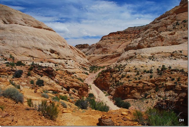
Notom Road starts in Capitol Reef National Park and goes south through BLM lands, private lands, back into the National Park and back out again.  Eventually it ends at the Colorado River.  The first 10 miles is paved, then it is a good dirt/gravel road for the next 30 or so miles before it becomes paved again.  We did the first 10 miles of paved, then another 12 of unpaved.  And the scenery was just incredible!

05-25-14 B CR Notom Road (19)

05-25-14 B CR Notom Road (14)

Check out these homes – what a view:

05-25-14 B CR Notom Road (22)

05-25-14 B CR Notom Road (24)

The views continue:

05-25-14 B CR Notom Road (37)

05-25-14 B CR Notom Road (43)

05-25-14 B CR Notom Road (45)

Farms and Greenery – what a treat:

05-25-14 B CR Notom Road (69)

05-25-14 B CR Notom Road (66)

05-25-14 B CR Notom Road (77)

05-25-14 B CR Notom Road (51)

05-25-14 B CR Notom Road (59)

The dark clouds started rolling in and I was a little concerned because we had crossed several washes. So we turned around and headed back.  This is where we had lunch:

05-25-14 B CR Notom Road (90)

05-25-14 B CR Notom Road (92)

05-25-14 B CR Notom Road (95)

We continued back to the park:

05-25-14 B CR Notom Road (103)

05-25-14 B CR Notom Road (108)

05-25-14 B CR Notom Road (109)

05-25-14 C Capital Reef NP East Side (2)

Interesting:

05-25-14 C Capital Reef NP East Side (5)

05-25-14 C Capital Reef NP East Side (6)

The area where the older boys slept:

05-25-14 C Capital Reef NP East Side (10)

05-25-14 C Capital Reef NP East Side (15)

05-25-14 C Capital Reef NP East Side (37)a

05-25-14 C Capital Reef NP East Side (39)

05-25-14 C Capital Reef NP East Side (41)

05-25-14 C Capital Reef NP East Side (47)a

05-25-14 C Capital Reef NP East Side (48)

05-25-14 C Capital Reef NP East Side (68)

You can really see the uplift here:

05-25-14 C Capital Reef NP East Side (61)

05-25-14 C Capital Reef NP East Side (70)

05-25-14 C Capital Reef NP East Side (71)

05-25-14 C Capital Reef NP East Side (76)

What a wonderful day – Smile!

IMG_2132755054786

5/27/2014

May 23 - 24, 2014 Rainy Days

Friday, 23rd

We woke to clouds and as the day progressed it became more clouds, then rain, then thunder and lightning, oh my.  So we just hung around.  I went thru all my pictures and updated my blogs – will publish when we get internet access.  Even did a little beading – Smile.

Saturday, 24th

We woke to clouds and a little sun every now and then.  We decided to check out a Forest Service Campground south of Torrey and check out some other Day’s End sites along the way. 

The Forest Service Campground (Singletree) was at 8300’.  On the way up the mountain, it started to rain, then hail, then snow – oh my.  And it was cold. 

This was our backup campground if we could not get into the National Park – very nice and we will put this on our list to stay in the future.  (FYI, They are looking for a campground host for this campground.)

On the way back down the mountain, the clouds were dramatic.

05-24-14 Capital Reef Area (6)

05-24-14 Capital Reef Area (10)a

From there we headed to Loa for some grocery shopping- this area is tough on finding grocery stores.  Afterwards we had lunch at their deli and checked our email messages. 

The scenery on the way back:

05-24-14 Capital Reef Area (14)

05-24-14 Capital Reef Area (17)

05-24-14 Capital Reef Area (20)

05-24-14 Capital Reef Area (32)

05-24-14 Capital Reef Area (36)

WOW!

Hopefully tomorrow will be nicer – still have another road trip to do.

Stay tuned and enjoy today.

IMG_22713295927425

May 22, 2014 Capital Reef National Park Scenic Drive

Today’s journey took us on the Scenic Drive of Capital Reef National Park.  This road follows the western face of the Waterpocket Fold.  The Scenic Drive is a portion of the original road through the Waterpocket Fold.  Ancient peoples used the route for centuries.  After settlement along the Fremont River, the ancient trail was developed into a wagon road in about 1884. Early explorers and prospectors called the fold a “reef” – a barrier of sandstone cliffs almost a hundred miles long. It was used by the settlers, Mormon church leaders, miners, and by cattle and sheep ranchers when they moved their herds between the high country to the west and the lowlands to the east.  The road was unpaved and passed through the dangerous narrows at Capitol Gorge.  Flash floods periodically transformed the usually dry stream bed in the gorge into a raging river, sometimes stranding unwary travelers.  This gravel road was the only one through the Waterpocket Fold until the completion of Highway 24 in 1962.

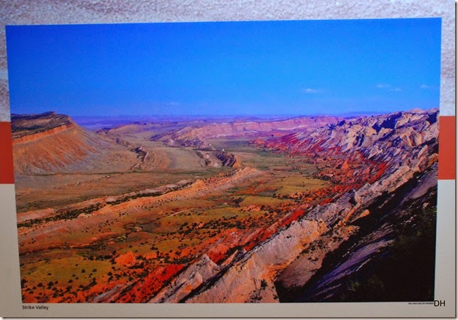
The centerpiece of Capitol Reef National Park is the Waterpocket Fold, a gigantic wrinkle in the Earth’s crust called a monocline or stair step fold – one of the largest in North America.

After the rock formations were deposited and solidified, enormous compressional forces in the earth caused these sedimentary rock layers (called strata) to be uplifted, tilted, and folded.  Over time, erosion has exposed these formations.  Different types of rocks erode at different rates in a process called differential erosion.  This differential erosion is one reason for the many landforms – cliffs, valleys, domes, ledges, etc. – in the park.

Aerial view of the Waterpocket Fold:
05-21-14 Capital Reef NP Area (69)a

And away we go:

05-22-14 Capital Reef NP (3)

Side trip on the Grand Wash Road:

05-22-14 Capital Reef NP (18)

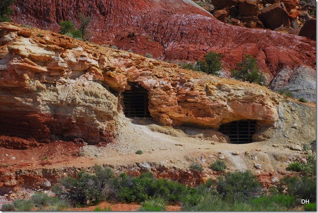
Notice the entrances to the Oyler Mine.  This mine produced some of the richest uranium ore in the Capitol Reef area.  The first claim on the mine was filed in 1901.  In the early 1900’s, the uranium was used for medicinal purposes.  Later, it was used for atomic energy.  The National Park Service has now closed the mine for both health and safety reasons.
05-22-14 Capital Reef NP (22)

05-22-14 Capital Reef NP (23)

05-22-14 Capital Reef NP (35)

05-22-14 Capital Reef NP (50)

There was a hike at the end of the road but we decided to do the Capitol Gorge hike instead.  Maybe later on, we will hike to the Narrows.

Back on Scenic Drive:

05-22-14 Capital Reef NP (55)

In many of these photos, you will see boulders along the road.  I just had to get a picture by one to show the size of these “rocks.”

Checking to see if any are rolling down the hill:

05-22-14 Capital Reef NP (62)

They are HUGE:

05-22-14 Capital Reef NP (63)

05-22-14 Capital Reef NP (68)

The entrance to Capitol Gorge:

05-22-14 Capital Reef NP (75)

Strange looking rock:

05-22-14 Capital Reef NP (88)

In some areas, the road and the wash were the same – I would not want to be here when it rained:

05-22-14 Capital Reef NP (91)

05-22-14 Capital Reef NP (97)

05-22-14 Capital Reef NP (101)

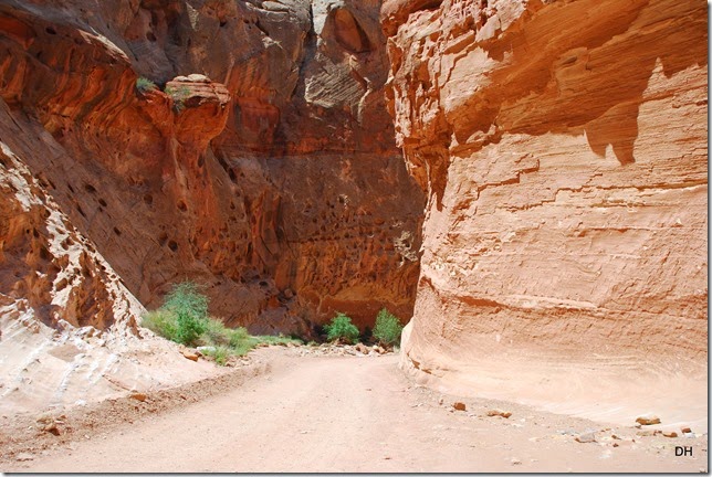
The dark stripes on the wall above are known as desert varnish.  It is a thin brown or black coating found on exposed rock walls in the dry environment of the desert.  It forms slowly on non-soluble rock surfaces, and consists in large part of clay colored by iron and manganese oxides.

The holes on the wall above are like smooth craters.  Most of the rock is sandstone – grains of dune sand weakly cemented by water-soluble minerals.  Where water seeps between layers, it may dissolve the cement, forming cavities which catch more moisture.  The cliff becomes pitted like weathered bone.

A short video of our drive: 

Capitol Gorge Drive  http://youtu.be/4fLi_6rap1g

WOW!!!
05-22-14 Capital Reef NP (111)

05-22-14 Capital Reef NP (116)

05-22-14 Capital Reef NP (130)

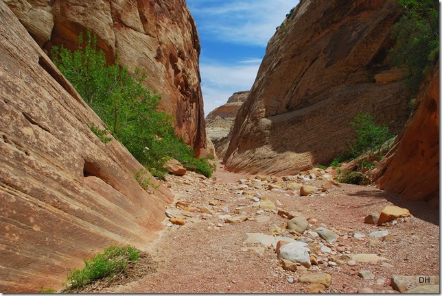
At the end of the road, we parked and off we went down the trail – which was the wash and the old gravel road.

05-22-14 Capital Reef NP (137)

We made a stop at the petroglyphs:

05-22-14 Capital Reef NP (140)

05-22-14 Capital Reef NP (142)

05-22-14 Capital Reef NP (145)

05-22-14 Capital Reef NP (154)

05-22-14 Capital Reef NP (158)

Yep, this was the road.  Can you imagine traveling this way – Yikees!

05-22-14 Capital Reef NP (165)

This wall was known as the Pioneer Register.  It’s earliest date is 1871, when two prospectors scratched their names in the rock wall of Capitol Gorge.

05-22-14 Capital Reef NP (172)

We continued on down the trail:

05-22-14 Capital Reef NP (174)

05-22-14 Capital Reef NP (180)

05-22-14 Capital Reef NP (181)

05-22-14 Capital Reef NP (184)

We found the sign for the Tanks pointing up but finding the trail was another thing.  Here is part of the trail:

05-22-14 Capital Reef NP (192)

05-22-14 Capital Reef NP (194)

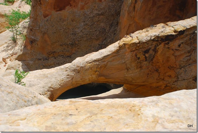
This is known as the “Tank” area.  It is a group of pockets hollowed out as water swirls over ledges in the streambed.  The Waterpocket Fold is named for the sandstone cisterns.  While the surrounding desert bakes, the pockets may hold gallons of rainwater.

05-22-14 Capital Reef NP (196)

05-22-14 Capital Reef NP (196)c

There was even an arch:

05-22-14 Capital Reef NP (198)

05-22-14 Capital Reef NP (202)

The views, oh my:

05-22-14 Capital Reef NP (204)

The trail below:

05-22-14 Capital Reef NP (186)

05-22-14 Capital Reef NP (209)

We made our way to the trailhead and had lunch – with a visitor:

05-22-14 Capital Reef NP (222)

And then we slowly made our way back to the Scenic Drive:

05-22-14 Capital Reef NP (232)

05-22-14 Capital Reef NP (236)

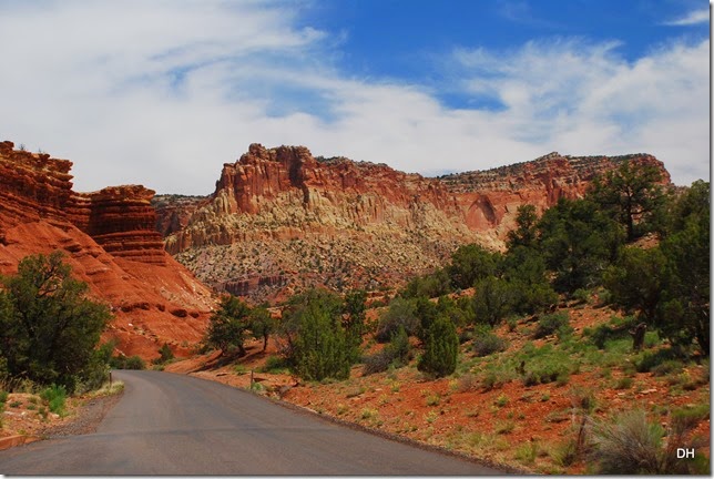
Notice how the rocks have changed color as the day goes on.  It is amazing to see how red and fiery they become as the mid-afternoon to evening approaches.
05-22-14 Capital Reef NP (243)

05-22-14 Capital Reef NP (247)

05-22-14 Capital Reef NP (252)

05-22-14 Capital Reef NP (257)

05-22-14 Capital Reef NP (262)

Back home, we had afternoon social with our neighbors and just relaxed the rest of the day.

Another wonderful day.

Enjoy today.

!cid_B3DBC925C73F47FD9DD5441A14230E4B@ownera8ab12b31