About a year ago I read a fiction book about the “Mound Peoples” of the Mississippi and the earthquakes and flooding around 1000 AD and then again in the 1800’s. Wondering if it was true, I “goggled it” (don’t you just love the internet!). Anyway I found many theories on the “Mound People” so not sure what may have been true in the book BUT I did find that there was a large earthquake centered around the New Madrid, MO area in 1811 and 1812. When I knew we were heading west by this route, it became one of our destinations.
This morning found us at the New Madrid Historical Museum that was once the “First-Chance, Last-Chance Saloon” in the Riverboat Era where we met the caretaker “Dorothy” also known as “Granny.” What a wealth of information, charm and humor. We had a GREAT time.


She started us out with two 10 minute movies. The first was about the New Madrid area and this area of the Mississippi from the Mississippian Peoples and Mound Peoples and what the archeologists have found; to the settling of the area and history, earthquakes, floods, Civil War, industry and up to the present time. Great overall introduction to the area. The second film was about the earthquakes of 1811 and 1812 – great films.
After the films were over, we entered the “Mound Peoples” Room and learned a little on their lives:

Next area was the “earthquake” area where we spent some time learning about the 1811-1812 earthquakes and the New Madrid Fault Line.
“The four earthquakes:
- December 16, 1811, 0815 UTC (2:15 a.m.); (M ~7.2 – 8.1) epicenter in northeast Arkansas. It caused only slight damage to manmade structures, mainly because of the sparse population in the epicenter area. The future location of Memphis, Tennessee, experienced level IX shaking on the Mercalli intensity scale. A seismic seiche propagated upriver, and Little Prairie (a village that was on the site of the former Fort San Fernando, near the site of present-day Caruthersville, Missouri) was heavily damaged by soil liquefaction.
- December 16, 1811, 1315 UTC (7:15 a.m.); (M ~7.2–8.1) epicenter in northeast Arkansas. This shock followed the first earthquake by five hours and was similar in intensity.
- January 23, 1812, 1515 UTC (9:15 a.m.); (M ~7.0–7.8) epicenter in the Missouri Bootheel. The meizoseismal area was characterized by general ground warping, ejections, fissuring, severe landslides, and caving of stream banks. Johnson and Schweig attributed this earthquake to a rupture on the New Madrid North Fault. This may have placed strain on the Reelfoot Fault.
- February 7, 1812, 0945 UTC (3:45 a.m.); (M ~7.4–8.0) epicenter near New Madrid, Missouri. New Madrid was destroyed. In St. Louis, Missouri, many houses were severely damaged, and their chimneys were toppled. This shock was definitively attributed to the Reelfoot Fault by Johnston and Schweig. Uplift along a segment of this reverse fault created temporary waterfalls on the Mississippi at Kentucky Bend, created waves that propagated upstream, and caused the formation of Reelfoot Lake by obstructing streams in what is now Lake County, Tennessee.
Shaking Caused Sand Blows, River Bank Failures, Landslides, and Sunken Land
The earthquakes caused the ground to rise and fall - bending the trees until their branches intertwined and opening deep cracks in the ground. Deep seated landslides occurred along the steeper bluffs and hill slides; large areas of land were uplifted permanently; and still larger areas sank and were covered with water that erupted through fissures or craterlets. Huge waves on the Mississippi River overwhelmed many boats and washed others high onto the shore. High banks caved and collapsed into the river; sand bars and points of islands gave way; whole islands disappeared. Surface fault rupturing from these earthquakes has not been detected and was not reported, however. The region most seriously affected was characterized by raised or sunken lands, fissures, sinks, sand blows, and large landslides that covered an area of 78,000 - 129,000 square kilometers, extending from Cairo, Illinois, to Memphis, Tennessee, and from Crowley's Ridge in northeastern Arkansas to Chickasaw Bluffs, Tennessee. Only one life was lost in falling buildings at New Madrid, but chimneys were toppled and log cabins were thrown down as far distant as Cincinnati, Ohio, St. Louis, Missouri, and in many places in Kentucky, Missouri, and Tennessee. “
More information:


There was an area where you could build a wooden home with pillars, plywood and Velcro on a moving plate so Andy and I and another museum visitor set about to building a two story home while 3 other visitors watched us. Then we started the plate moving. Our home without Velcro fell apart at level 4, with Velcro at level 5. Then we turned it up to 8 which is what these earthquakes would have been. What a VISUAL for us all – WOW!!! There would be no way to stand. Even laying prone on the floor might be difficult without holding on to something.
There is so much information on the earthquakes and the New Madrid Fault Lines and they are finding out more information every day.
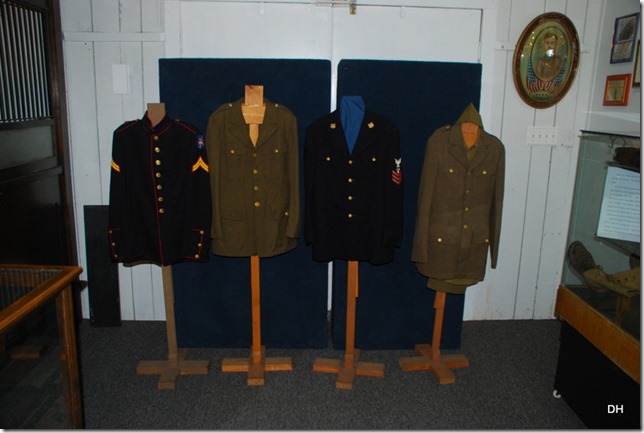
The next two rooms were dedicated to the wars with emphasis on the veterans from the county and also on the importance of the Mississippi River Ports in this area during the Civil War.
Donated uniforms:
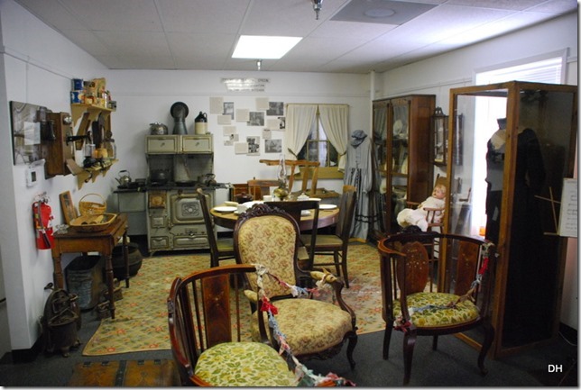
The second floor was set up like a home from the 1800’s with donated furniture, clothing, and accessories:

A child’s room – The quilt on the wall is from the early 1900’s when the town had 900 residents and every one signed the quilt:

Kitchen and Sitting Area:
Back downstairs we spent some time talking with Dorothy. The area continues to have earthquakes and sand boils (where seismic activity liquefies the soil and the sand from below boils to the top.) Her answer: “Oh honey, the farmers cover the sand boils every year with soil and then plant crops.”  She then told us two places where we might see them (we didn’t – only harvesting going on.)
Here is what they look like from above – see the sandy circles:

What a wonderful museum! I am so glad that there were only a few of us so we got to spend some time at all the exhibits. This is one of the stops on the Steamboat cruises and 2 days ago, there were 300 people going thru the museum – Yikees!
Now to the Mississippi River Walk and Observation Deck and The Fault Line:


Looking down Main Street:

New Madrid sits at the top of the Bend:

This is looking toward the top of the bend facing east. This is also the area where there were a few waterfalls during the earthquakes:
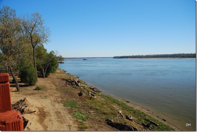
This is facing south down along the west side of the bend:

The original site of New Madrid is now located in the river. The town fell 12 feet and flooded – can you imagine!
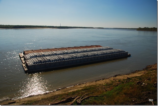
We lingered a while watching the barges and then walked to the boat dock. They have really done a nice job on the walk.


Back in the car we were off to find sand boils – nope did not find any. Oh well!
We stopped at one of the local restaurants, Evelyn's, for lunch – it was yummy. We made a quick stop for supplies and then headed back home.
This evening we went to Lamberts – home of the throwed rolls – for dinner. There are three sites (Sikeston, MO; Foley, AL; and Ozark, MO) and now we have been at all three. Lots of fun and yummy too!
http://www.throwedrolls.com/

What a great day!
There is a wealth of information out there on these earthquakes and on the New Madrid Fault Line. There was a great book in the museum that gave mile markers and information on what to see and do along the 150 mile fault system. If we decided to explore this area more, that book would really be handy. I would also stay in Charleston at Boom Land again. It is a basic campground but full hookups for $12.00 – can’t beat it…
Tomorrow we continue our journey so stay tuned and enjoy today.


