Showing posts with label ALCAN. Show all posts

9/03/2009

September 1, 2009 – The ALCAN and the Cassiar

Another beautiful day – :-)

We continued down the ALCAN and here are more views from the road.

Teslin Lake:

 09-01-09 Teslin to Watson Lake 002

Other views:

09-01-09 Teslin to Watson Lake 007

09-01-09 Teslin to Watson Lake 024

09-01-09 Teslin to Watson Lake 011

If you look closely, you can  see names and messages in stones.  We found these all along the highway.  In some areas, people painted the stones different colors:

09-01-09 Teslin to Watson Lake 013

We made a stop at Junction 37 for gas (high price – Yikees) and then turned on the Cassiar Highway.

Here is what greeted us after 2 miles (notice the construction sign):

09-01-09 X Cassiar Highway 001

And the road went from this:

09-01-09 X Cassiar Highway 006 To this:

09-01-09 X Cassiar Highway 007 Then this:

09-01-09 X Cassiar Highway 012

And it continues:

09-01-09 X Cassiar Highway 014

Even more so:

09-01-09 X Cassiar Highway 049

Did you notice no lines?  It is an interesting ride and the scenery – Spectacular! – notice in the above pictures – :-))

We passed by many lakes – notice the blue colors:

09-01-09 X Cassiar Highway 011  

09-01-09 X Cassiar Highway 019

And even more wildlife:

09-01-09 X Cassiar Highway 024

09-01-09 X Cassiar Highway 040

We decided to stop after 100 miles on this road and found this gem – Dease River Crossing RV and Campground - $15.00 Canadian – WOW.  Right by this beautiful lake.  We sat out enjoyed the sun, the scenery and the campfire.  Our neighbors are from Maryland and joined us later in the evening at the campfire.  What a nice end to an edgy day! 

09-01-09 X Cassiar Highway 056

If the weather holds we may even stay another day – so stay tuned.


Stats:

Miles Traveled:

Routes Traveled: 257 Miles

Yukon:  PH-1 (Alaskan Highway)

British Columbia: PH-1 (Alaskan Highway); PH-37 (Cassiar Highway)

August 31, 2009 – The ALCAN South

We woke to beautiful sunny skies and decided this would be a short travel day. Why?  We wanted to sit in the sun, in the woods, and enjoy a campfire.  So we found Teslin Lake Provincial Park and that is what we did all afternoon – sat in the sun, surrounded by trees and enjoyed a campfire (provincial parks in the Yukon provide free firewood – :-))).

Here is our site:

08-31-09 Whitehorse to Teslin 002

08-31-09 Whitehorse to Teslin 004 

Here is the lake:

08-31-09 Whitehorse to Teslin 006

08-31-09 Whitehorse to Teslin 007 

08-31-09 Whitehorse to Teslin 005 

According to the one report, there were to be medium aurora displays tonight so I got up a few times during the night to check.  Lots of stars but no aurora – oh well!

Stats:

Miles Traveled:  96 miles

Routes Traveled:

Yukon: PH-1 Alaskan Highway

8/31/2009

August 30, 2009 – Wooly Mammoths, Cars, and Follies

Our morning and afternoon were spent at two museums.  The first was the Yukon Beringia Interpretive Center. 

“The lost sub-continent of Beringia dates back to the last great ice age.  While the rest of Canada lay frozen under massive sheets of ice, a region encompassing eastern Siberia, Alaska and Yukon remained untouched by glaciers.  Sea levels dropped and a grassy tundra appeared, supporting a variety of animal and plant life.”

“The new world’s earliest human inhabitants moved into what is now North America from western Beringia at least 24,000 years ago.  Following the herds of mammoth and giant bison, the First People of the ‘New World’ were resourceful and well-adapted to hunting the large mammals of the steppe tundra.  Ultimately, they survived them.”

What a neat place.  We found out that as miners were digging in the permafrost for gold and other minerals, they unearthed some of these bones.   Some are also found after flooding in the river beds.  Amazing.

The Scimitar Cat

 08-30-09 Whitehorse 002

The Wooly Mammoth in the center and the Giant Sloth on the left:

08-30-09 Whitehorse 008

From there we went to the Yukon Transportation Museum right next door.  This plane is actually the world’s largest weathervane (and we did see it move – WOW!):

08-30-09 Whitehorse 033

08-30-09 Whitehorse 031

The museum contained all modes of transportation in the Yukon from dog sledding to modern vehicles.  They had a nice section on trains and the part they played from the gold rush thru the wars up to modern tourism.  There was a section on building the Alaskan Railroad and the suppliers.  Here are two of those vehicles:

08-30-09 Whitehorse 040

08-30-09 Whitehorse 046

And one of Andy’s favorites – a 1928 Chevy.

08-30-09 Whitehorse 062

We also saw some interesting movies in each of the museums.  We would definitely recommend visiting the both.

Back at the MH, we relaxed and then this evening went to town to see “The Frantic Follies” – a vaudeville review.  What a wonderful show!!

Tomorrow we head out.  We are still not sure if we are going to Carcross or just head to Watson Lake area so stay tuned – :-))

8/30/2009

August 28, 2009 – Travel to Whitehorse

We left Haines this morning in the sunshine, made it thru Canadian customs with no issues and headed up the pass.  And the clouds that were disappearing in Haines were hanging out in the mountains – LOL!

08-28-09 Travel to Whitehorse 009

The mountains behind the clouds:

08-28-09 Travel to Whitehorse 014

Coming into Haines Junction:

08-28-09 Travel to Whitehorse 020 

We were going to stay at the Million Dollar Falls Campground – but it was raining.  So we moved on.  As we were coming up the road, a huge grizzly ran right out in front of us.   Andy hit the brakes and I really thought we were going to hit him – oh my!!!  Sorry no pictures – LOL!!! 

We then went to Kathleen Lake Campground – still raining so we decided to just keep on going. 

We pulled in to a rest area and realized it was one of the stops we made on our way up.  So here are more then and now pictures:

April:

04-24-09  B Alaskan Highway - Yukon 039

Now:

08-28-09 Travel to Whitehorse 033

April:

04-24-09  B Alaskan Highway - Yukon 038 Now:

08-28-09 Travel to Whitehorse 029

April:

04-24-09  B Alaskan Highway - Yukon 040 Now:

08-28-09 Travel to Whitehorse 032

The red that you see on the mountain is the plants changing color for the fall.

08-28-09 Travel to Whitehorse 023  

We arrived in Whitehorse and are staying at the Pioneer RV Park for a few days.  As we were getting set up, Jan and Ken stopped by.  We met them at the Wasilla/Palmer Elks back in July and have been emailing ever since but just never crossing paths.  So it was good to see them and we made plans for dinner tomorrow.

And it was a real early night for me – just not feeling well.  I think it was a little left over from the boat trip yesterday.  (I may just quit going on boats!!)

Until tomorrow.

Stats:

Miles Traveled:  250 Miles

Routes Traveled:

Alaska: AK-7 (Haines Highway)

British Columbia:  PH-4 (Haines Highway)

Yukon: PH-3 (Haines Highway); PH-1 (Alaskan Highway)
8/26/2009

August 23, 2009 – The Bears at Haines

We left this morning and continued around Kluane Lake – what a difference from April.

This is from April:

04-24-09  B Alaskan Highway - Yukon 163

Now:

08-23-09 Alaskan Highway - Yukon 042

April:

04-24-09  B Alaskan Highway - Yukon 179

Now:

08-23-09 Alaskan Highway - Yukon 037

The road around the lake:

08-23-09 Alaskan Highway - Yukon 020

This monument is at the junction of the Alaskan and Haines Highways:

08-23-09 B Haines Highway 001

And we made the turn to go to Haines.  Some scenes along the way:

08-23-09 B Haines Highway 015

08-23-09 B Haines Highway 029

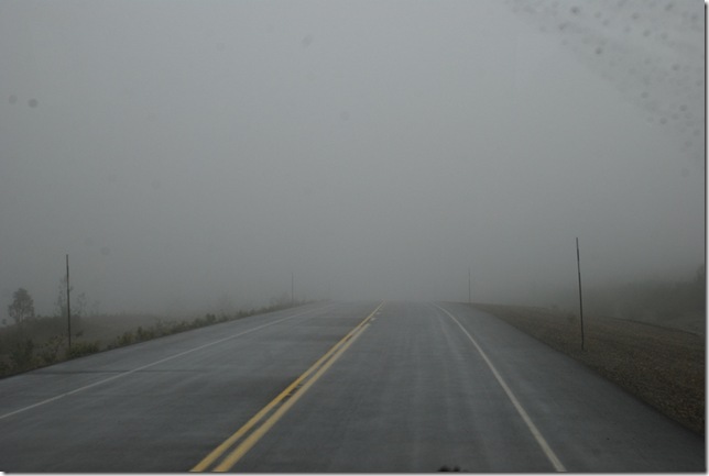
This is the top of Chilkat Pass.  The scenery is supposed to be incredible but this is what we saw until we came out of the pass – LOL!  (Maybe on the way back – :-))

08-23-09 B Haines Highway 039

We went thru US Customs with no problems and came down into the Chilkat River Valley – this is also a glacial stream.

08-23-09 B Haines Highway 044

The Chilkat Bald Eagle Preserve is on this river.  In Oct/Nov, thousands of Bald Eagles migrate here.  There is a late run of salmon plus this river does not freeze early.  We were told they gather here during those months and then usually move further south when the river freezes.  Hopefully we will get to see some while we are here.

Haines is a small town that is situated on a Fjord surrounded by the Chilkat River, the Chilkoot River and Lake and the Lynn Canal.  We decided on the Chilkoot River State Campground.  Once we set up, we went to town to the visitor center (Closed) and to find information on some of the tours we want to do.  I was able to pick up some brochures so stay tuned.

On our way back, how about this:

08-23-09 C Chilkoot River 014

08-23-09 C Chilkoot River 028 

He was having a good time catching and eating the salmon.

This is the fish counter fence on the Chilkoot River – about 3/10 of a mile from where we are camped.  They considered this area a “Bear Zone” – bears can feed comfortably without humans bothering them – so this was taken by car as we drove past.  And the fish are jumping!

08-23-09 C Chilkoot River 112

Another grizzly enjoying his dinner:

08-23-09 C Chilkoot River 127a 

08-23-09 C Chilkoot River 211a


What a blessing to see these incredible creatures!

Stats:

Miles Traveled: 212 Miles

Routes Traveled:

Yukon:  PH-1 (Alaska Highway); PH-3 (Haines Road)

British Columbia: PH-4 (Haines Road

Alaska: AK-7 (Haines Highway); Lutak Road